A view of Middle Bass Island, left, and Ballast Island, right. Both are in Ohio. The southernmost tip of Canada is visible between them. Image: Mike Gora
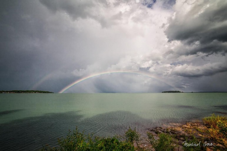
The first submission for our Great Lakes border challenge captures a colorful vista along the Ohio-Ontario border.
Echo-reader Mike Gora snapped this photo from the eastern shore of Middle Bass Island in Ohio’s share of Lake Erie. The double-rainbow connects the easternmost point of Middle Bass Island (left) and the smaller, private Ballast Island (right), both of which are located in Ohio.
Below the rainbow’s center is a glimmer of Canada’s southernmost landmass, Middle Island, Ontario. The view offers 10 to 15 miles of the United States/Canada border.
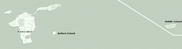
Middle Bass and Ballast Island, OH. Middle Island, ON. Image: Mapbox
To submit your own Great Lakes border image, email an original photo with a short description to GreatLakesEcho@gmail.com. Submissions will be considered for our regular series — Photo Friday.