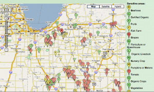
Now it’s easier than ever to search for endangered species habitats and organic farms in Indiana.
An interactive map shows the locations of these sensitive areas so pesticide applicators know where to avoid pointing the nozzle.
A state agency in charge of regulating pesticide use in agricultural areas developed the map to “facilitate communication between applicators and growers.”
But it’s also interesting to see where bees and organic livestock are kept throughout the Hoosier State.
The mashup has the same functionality of a Google map – users can search for a specific location or navigate around the state. Icons containing rolled up data represent locations of crops and streams.
Click on the user guide for more information.
