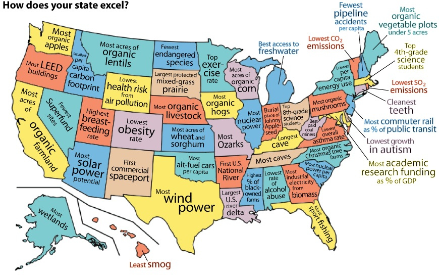
Map: Mother Nature Network
What do Great Lakes states do well? And what do they need to work on? This fun set of maps compiled by Big Think’s Strange Maps illustrates each state’s best and worst attributes – many are environmental.
Michigan earned “best freshwater access” for its 3,288 miles of Great Lakes coastline. But it also has the highest unemployment rate and greatest threat from Asian carp.
Tornadoes and binge drinking plague states in the western Great Lakes basin. But with all those great Wisconsin microbrews, could you blame them? Wisconsin also has the most acres of organic corn, according to the environmental map.
Pennsylvania has plenty of hunters and organic mushrooms, but can’t fix its failing dams.
Despite tiring commutes, New Yorkers trade in cars for trains and other mass transit only to face the most risk from air pollution. On the bright side, the state has the lowest per capita energy use.
The most vice presidents may be born in Indiana, but it’s the least green state in the country and has the most trash. (There’s a politically incorrect joke in there somewhere.)
Ohio is a state full of nerds. It has the highest library use rate and the top eighth-grade science students, according to the maps.
With its abundant nuclear power, toxic waste accidents and robberies, Illinois is the most average, according to the maps.
“The United States of Awesome” map was published by a political blog called Political Language. The Pleated Jeans, a humor blog, published the United States of Shame map. The Mother Nature Network put together the best and worst environmental maps.
All claims have references; some are more reliable than others. Big Think’s original Strange Maps post calls the maps anecdotal, but that doesn’t “detract from the popularity of the format.”
Is there any truth to these maps?
*Updated for accuracy, June 8, 2011 at 11:14 a.m.
That would have to be Wisconsin: the Dairy State, no (presuming the question is about ag manure)
Which state produces the most manure? (reusable, of course)