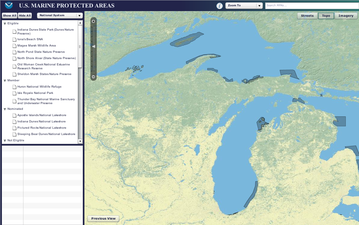
Great Lakes shipwrecks are among the most protected areas of the region. Map: United States Marine Protected Areas system
Navigate Great Lakes shipwrecks, fish sanctuaries and state park preserves with an interactive map of protected marine areas.
Federal, state and local governments designate marine areas to provide long-term protection for natural resource and ecosystems.
The West Coast and Pacific Islands boast the most number of protected areas in the national system; the Great Lakes region has about four percent.
Michigan’s bottomland preserves, natural areas and trout preserves and Wisconsin’s shipwrecks are among the most protected areas in the region, according to an inventory of marine areas.
Many of Minnesota’s fish sanctuaries are also protected.
State natural resources departments manage most of the areas, but historical preservation societies are also involved – the Wisconsin Historical Society oversees many of the state’s Lake Michigan shipwrecks.
Although protection focuses on each ecosystem, the majority of areas are still open to recreational and commercial activities like fishing and boating, according to the inventory.
The Magee Marsh Wildlife Area in Ohio, the Little Knife River in Minnesota and Indiana Dunes State Park in Indiana are among areas with recreational fishing restrictions.
Most protected areas in the Great Lakes region were added to the inventory in 1994. There hasn’t been a classification since 2004.
NAVIGATION
Zoom into the Great Lakes and click “show all” to get a better look at the region’s protected marine areas. It’s easier to see the shaded areas when the map is in “topo” or “imagery” view.
Users can view different levels of protection and government under the “national system” pull-down menu.
Clicking on the area in the left panel displays additional information, like when the area was established and the focus of protection efforts.
Users can download the map’s data.