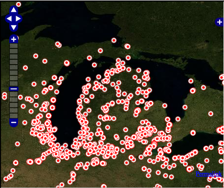
A map of zebra mussels from 2008 shows why invasive species are problem in the Great Lakes region. Map: Great Lakes Information Network
Explore the Great Lakes on your own terms with this customizable map-building tool.
The Great Lakes Information Network’s interactive map comprises data from a variety of regional agencies and organizations.
First, pick from 12 topics ranging from Great Lakes wildlife to climatology and inland waters. Each topic has a list of layers, like the distribution of zebra mussels and extent of trout streams.
Mix and match layers to find relationships or trends. Interesting combinations include spawning locations under “Biota” and buildings and dam locations under “Structures/Facilities.”
Don’t forget to choose a marker style for each layer. Bright colors like red and yellow are easier to see against map background.
The information network has a variety of mapping tools. Survey each lake in detail with the Map Explorer function or examine the network’s database of mapping data.