Digital artists create animated wind map

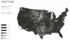
Photo: Hint.fm. Two digital artists recently released an animated map illustrating the speed and direction of surface winds across the U.S.

It’s ever changing patterns are driven by wind data from the National Digital Forecast Database kept by the National Oceanic and Atmospheric Administration. The database also feeds information to the administration’s Great Lakes current map released last month to help the public better understand lake currents. Unlike the water current map, the wind map is not affiliated with the federal agency. Visual collaborators Fernanda Viégas and Martin Wattenberg warn the data is not reliable and that no one shouldn’t use it “…to fly a plane, sail a boat or fight wildfires.”

They refer to the wind map as a personal art project.

Photo Friday: Michigan Balloonfest lights up the night


The recent 28th annual Michigan Challenge Balloonfest  in Howell, Mich., provided a fun-filled weekend for attendees to play games, watch fireworks and enjoy the launch of several hot air balloons! The hot air balloon ‘glow’, in which pilots and their crew gather in the Landing Zone and fire up their balloons as darkness falls is a highlight of the Michigan Challenge Balloonfest. With 44 participants this year, the “glow” featured more than a dozen balloonists and their crew during the glow.  


The crew of the Sullair balloon, piloted by Shawn Raya, of Oxford, Michigan, launches the balloon for the “glow”.  

Above, Airwaves One (WHMI), PNC Bank, Michigan CAT, SullAir and “Andy”, sponsored by Paulsen’s Construction, show their colors.

Great Lakes coal shipments are down

Flooding that shut down the terminal at Duluth contributed to a 13 percent drop of coal shipments compared to a year ago.

Depressed demand and the lack of harbor dredging contributed to the drop.

Flash Point: Mark Schacter captures Cuyahoga River ruin and redemption

We asked Great Lakes photographers to send us favorite challenging Great Lakes shots and the story behind making them. Mark Schacter sent this photo and story. My challenge: how to capture in a single photograph a story of environmental ruin and redemption on Lake Erie? The subject was the Cuyahoga River, which rises in the northeast corner of Ohio and follows a 140 km U-shaped path before emptying into Lake Erie at Cleveland. One day in 1969 an oil slick on its surface caught fire in Cleveland. Although this was not the first time the filthy Cuyahoga had burned, Time magazine seized on the 1969 fire as emblematic of the devastating effects of water pollution in the US.

New books highlight Lake Superior’s allure

Lake Superior has long entranced us — with its fickle, dramatic beauty and threats, with its historic legacies and legends, with its immensity and with the people who live along its shores.

Now two new books highlight some of the reasons for our fascination and our awe.

Lake Ontario glints at spacecam

Sun glints off the surface of Lake Ontario in the lower right corner of this image taken recently by astronauts on board the International Space Station. The mirror-like effect is known appropriately as sunglint. NASA’s Earth Observatory reports the picture was taken when the station was over southeast Nova Scotia and about 740 miles from the centerpoint of the image. From this perspective you can see Lake Huron’s Saginaw and Georgian bays above and to the right of Lake Ontario, and the Finger Lakes of New York to its left. Sunglint also highlights Lake Erie to the west, but the angle makes it appear duller than Lake Ontario.

Record summer heat killing more fish

Summer fish kills are not unusual.

Heat and drought means less oxygen is dissolved in water.

This year there is more of both in the Great Lakes region, resulting in more fish kill reports than usual.