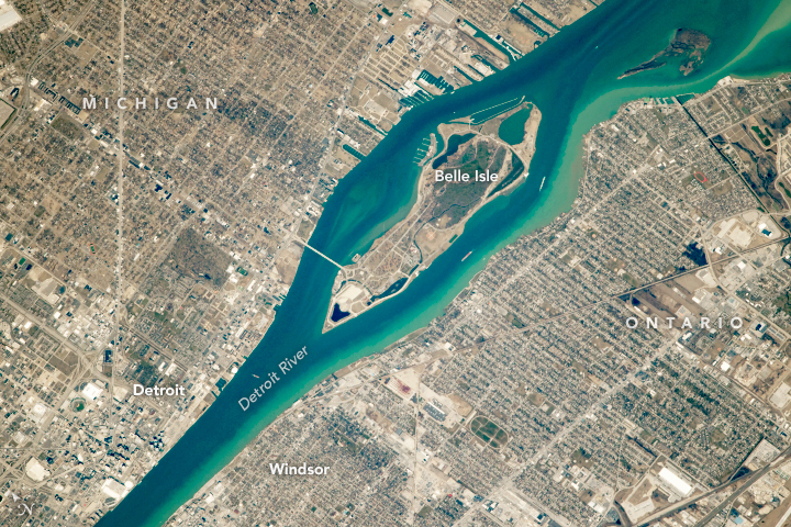
Photo of the Detroit River near Belle Isle in Detroit, Michigan, taken by an astronaut on board the International Space Station. Image: NASA Earth Observatory
By Will Grimm
An astronaut recently took this photo from space of the Detroit River’s Belle Isle for NASA’s Earth Observatory. The river travels about 30 miles from Lake Erie to Lake St. Clair and separates Michigan from Ontario. Its name is from the French Rivière Détroit, meaning “River of the Strait.”
The Detroit River is one of the most important waterways in the Great Lakes system, according to NASA’s post. Iron ore from Michigan’s Upper Peninsula and Minnesota makes up almost half of the commodities that pass through the Port of Detroit. Large cargo ships can be seen passing through the busy corridor in this image.
The river forms part of the U.S./Canadian international boundary. Belle Isle is entirely within the U.S.
Detroit, Michigan, and Windsor, Ontario, are across from each other. Both have long-standing connections to the automobile industry.