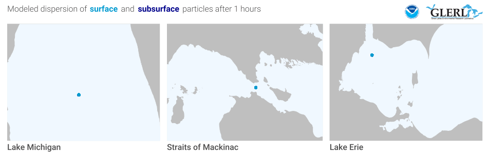
A model showing how fast pollution would spread in each location. Image: NOAA/Kaye LaFond
By Kate Habrel
You can watch water flow through the Straits of Mackinac with an online animation that shows it switch directions and reach speeds as fast as some Great Lakes rivers.
The animations are produced by the National Oceanic and Atmospheric Administration (NOAA). While they’re not updated in real time, they’re meant to show the predictability of the currents in the Straits.
And that’s important to help freighter captains predict the speed and direction of currents through the region and for search and rescue operations to find lost people and boats.
“We got a lot of press calls about the Straits and people wanting information,” said Kaye LaFond, a NOAA graphic designer who created the page. “We really needed a place to direct people to a home for our research.”
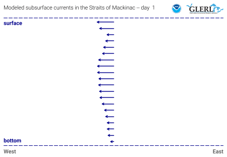
Model showing how currents on the surface run opposite those on the bottom during the summer. Image: NOAA/Kaye LaFond
Visitors to the page can watch the currents speed up, slow down and change directions. Perhaps the most startling discovery is the dynamic nature of the Straits. For example, currents at the surface flow in the opposite direction as currents at the bottom during the summer.
The system that made the animations possible monitors currents, temperatures, waves and water level fluctuations in real time. It’s been in place since 2004.
The model grew out of an effort to track pollution. Interest rose after an oil pipeline belonging to Canadian company Enbridge Inc. ruptured. It contaminated the Kalamazoo River near Marshall, Michigan.
A pipeline belonging to the same company runs underneath the Straits.
The model was used in a 2015 oil spill readiness exercise that predicted where the water currents would take pollution if that pipeline broke. The U.S. Coast Guard practiced boating maneuvers based on the information.
Supporters and opponents of the oil pipeline have expressed interest in the system, LaFond said. But the page is for anyone.
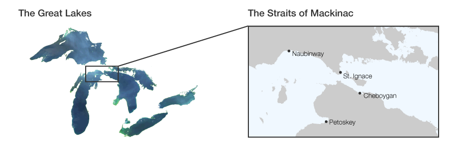
The location of the Straits. Image: NOAA/Kaye LaFond
Data from the Straits is part of an ongoing upgrade for even greater accuracy.
Previous models consisted of domains that cover specific locations, said Eric Anderson, an oceanographer at NOAA. The new one shows how the domains interact with each other.
“So we’re expanding our reach into spots we didn’t have before,” he said. “Even though we’ve had a model for each lake predicting these conditions, we’re now getting these to finer details.”
His lab has already received positive reaction to the animations through phone calls and social media, he said.
LaFond said she hopes it will inspire similar projects.
“It’s so important to us as a lab that the work our scientists are doing is made accessible to people,” LaFond said. “Because really, science is for all of us. It’s for everybody in the Great Lakes. It belongs to all of us and hopefully benefits all of us.”
Updates to the forecasting model will include the Huron-Erie corridor, the waterway that drains Lake Huron into the St Clair River, through Lake St Clair to the Detroit River and into Lake Erie.
Researchers also hope to upgrade systems monitoring Lake Michigan, Lake Superior and Lake Huron.