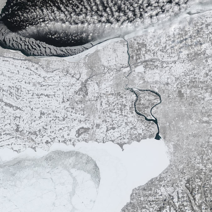
Manmade ice boom near the mouth of Lake Erie along the Niagara River. Image: NASA Earth Observatory, Jesse Allen
As Great Lakes ice coverage hovers around 80 percent, there’s no shortage of frozen landscapes to be seen.
This week Echo pulls a recent image from a NASA earth observation satellite.
The natural-color image, frames the U.S.-Canadian border and the Niagara River, flowing from a 98 percent frozen Lake Erie in the south to the 76 percent frozen Lake Ontario in the north.
Niagara Falls is visible midway between the lakes.
NASA’s Earth Observatory points out the sharp ice-water boundary near the mouth of Lake Erie.
It isn’t natural, and it’s called an ice boom.
But it’s reduced the amount of ice flowing into the Niagara River since 1964.
This year more than 200 pontoons for the boom were installed Dec. 15 after temperatures in Buffalo, New York hit 39 degrees Fahrenheit a week earlier.
According to the International Niagara Board of Control, the Lake Erie-Niagara River Ice Boom is installed to reduce ice jams and shoreline damage, while also maintaining the electrical power generated from the Niagara River.
Harsh weather forced late removal of the boom last year, and with record temperature lows, the average April 3 boom removal might again be too early.
