Water

Great Lakes Now coverage of Great Lakes Week 2015
|
Great Lakes Week in Chicago has ended, but you can catch highlights here.
Great Lakes Echo (https://greatlakesecho.org/author/kevin-duffy/page/2/)
Great Lakes Week in Chicago has ended, but you can catch highlights here.
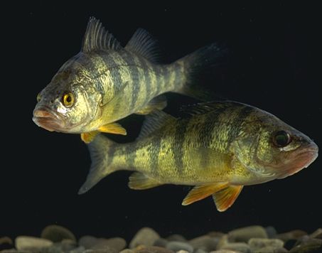
Climate-controlled growth chambers show that the negative impacts of climate change outweigh the positive ones for fish living in mild-temperature regions.
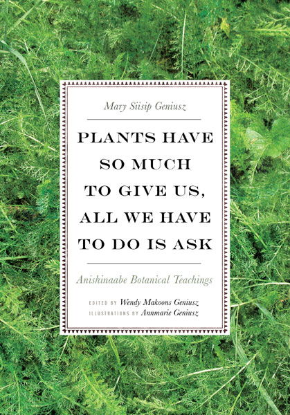
Mary Siisip Geniusz revives native Anishinaabe-Ojibwe plant knowledge with cultural and culinary anecdotes in her new book.
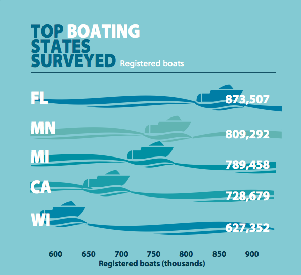
From state park visitors traversing a river trail to licensed fishers scoring a fish tale, 28 states measured water activity using park reports and other publicly available data.
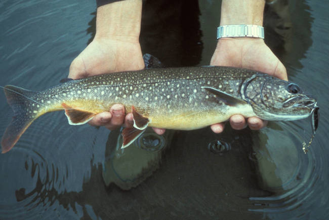
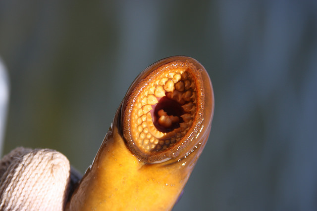
Researchers link alewife gene with vitamin B1 deficiency and the decline of lake trout.

Author Mike Nagel chronicles the business and philanthropic acumen of Michigan’s ‘Pine King’ in his new book.
Cryptic chemicals associated with life and death can push and pull this parasitic invader.
Michigan State University is fighting the state’s worst aquatic invaders with mobile lakeside education and free boat washes.
Scientists are swapping topographic maps for satellite images as part of a new NASA mission to create the first global inventory of the Earth’s surface waters. It could mean they contribute more to global warming than previously thought.
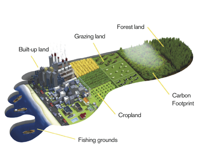
The nation hit Ecological Deficit Day recently, thanks in part to the Great Lakes states that use more resources than they regenerate.