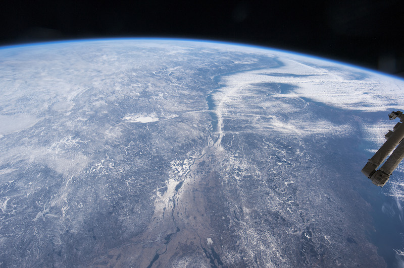
Daylight highlights clouds that cover the St. Lawrence River as it passes from the lower left to the upper right of the photo. Image: NASA Earth Observatory, Johnson Space Center
Astronauts aboard the International Space Station snapped these midwinter photos to display the day-to-night changes along the St. Lawrence River, which drains the Great Lakes.
The handheld camera caught cloud-formation along the Gulf of St. Lawrence as it fed moisture into the atmosphere, sweeping clouds across the Atlantic Ocean.
The St. Lawrence, which links the Great Lakes to the Atlantic Ocean, is clearly visible in the daytime image but disappears amid the bustling metropolitan at night.

City lights illuminate the metropolitan areas of Québec and Montreal along the St. Lawrence. Image: NASA Earth Observatory, Johnson Space Center
It’s framed by a distant green aurora along the horizon and is sure to please Aurora hunters as they peer into northern skies.
Read more or download high-resolution images at NASA’s Earth Observatory.
BONUS: See if you can spot the Manicouagan crater in the first image, one of oldest known and most visible impact craters on Earth.
