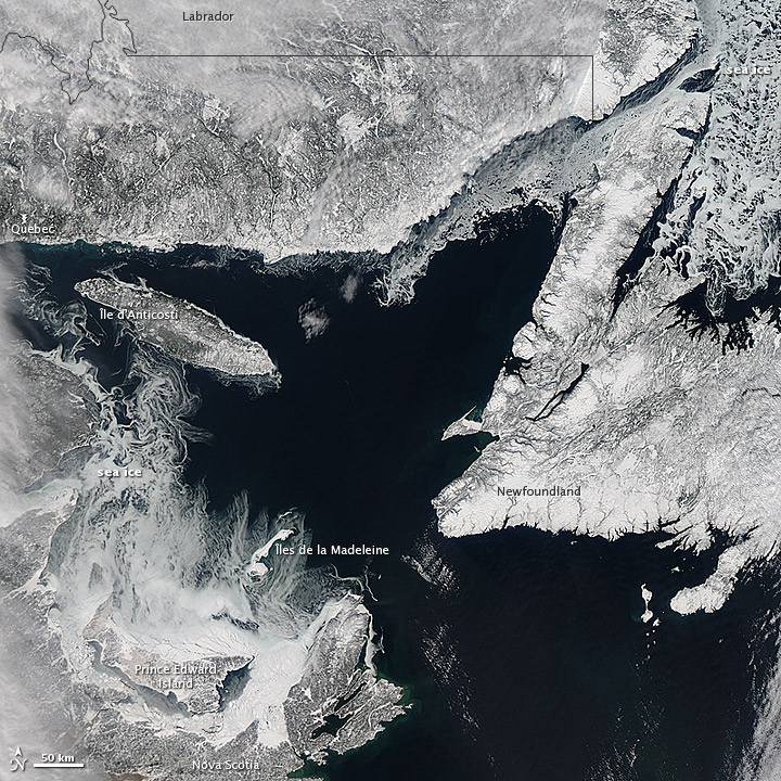
Sea ice forming in the Gulf of St. Lawrence as it reaches its annual maximum growth. NASA photo.
The Gulf of St. Lawrence, the outlet of the Great Lakes into the Atlantic Ocean, is building toward its annual peak accumulation of sea ice, according to a recent photograph captured from NASA’s Aqua satellite.
According to NASA, each year, the amount of frozen seawater, known as sea ice, in the Arctic Ocean builds from September through February or March as surface air temperatures drop below freezing. As it reaches the peak of its expansion, it begins to form in the Gulf of St. Lawrence.
Sea ice typically forms in layers, with younger layers being particularly thin. Many of these young sheets drift their points of origin, propelled by ocean winds and currents. In the photograph, examples of this wayward ice can be seen in the wispy sheets around ÃŽle d’Anticosti and in the seas north of Newfoundland. According to NASA, the ice surrounding Prince Edward Island appears thicker and is therefore more likely to have formed there as a result of cold north winds.

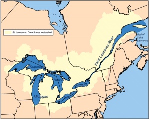
The Gulf of St. Lawrence is the outlet for the Great Lakes into the Atlantic Ocean. Image by Karl Musser via Wikimedia Commons.
NASA satellites have monitored the growth and retreat of sea ice since 1978. Since observation began, NASA has seen a decline in sea ice, a decline which accelerated with the dawn of the new century.