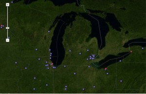
Clicking on a city shows a description of its drinking water source. Clicking this image takes the reader to the map. Photo: The Nature Conservancy.
An interactive map shows users where different communities draw their drinking water.
It works by zooming in on selected areas whereby clicking on a city shows descriptions of its water sources.
For example, Lansing, Mich. draws much of its water from 124 wells tapping an underground aquifer.
Fort Wayne, Ind. gets it from the St. Joseph River and the people of Parma, Ohio get theirs from Lake Erie.
The map was created by the Nature Conservancy.
