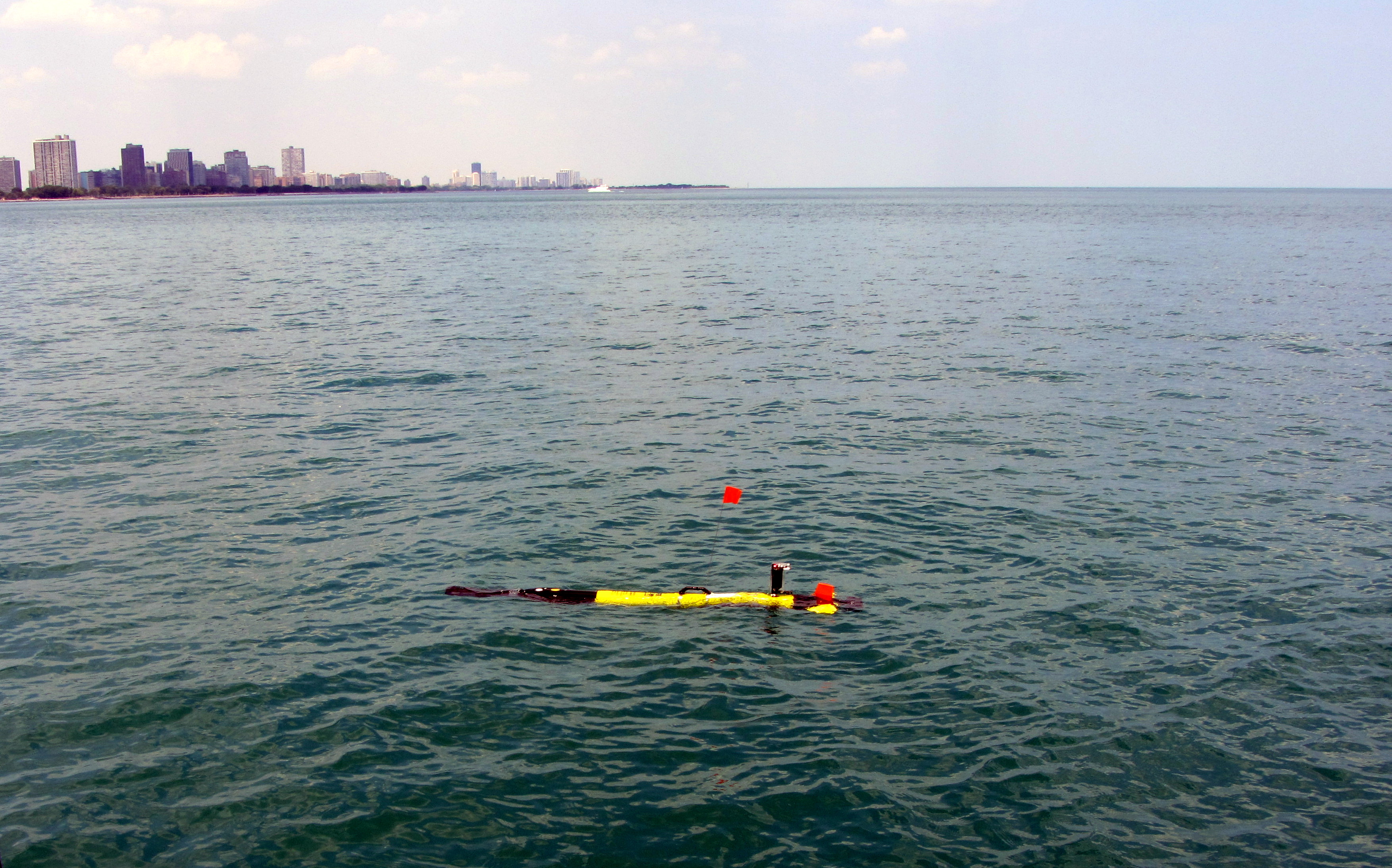
The Ecomapper surfaces in the Lake Michigan waters off the coast of Chicago. Photo: U.S.Geological Survey
Researchers hauled a robotic torpedo out of Lake Michigan Thursday after it finished surveying 26 miles of Chicago shoreline.
The bright yellow Ecomapper is a 5-foot long autonomous underwater vehicle (AUV) that collects water quality data with sensors in its nose.
A propeller pushes the robot, fins direct it and a small antenna checks it’s positioning with GPS.
The water temperature, dissolved oxygen levels, water chemistry and pH levels the robot collected will be used to improve the health of Chicago beaches, said Jim Duncker, a hydrologist at the U.S. Geological Survey’s Illinois Water Science Center. The survey is part of a nearshore water quality study by the U.S. Geological Survey and the Chicago Park District.
Researchers also measured how fast and in what direction the nearshore water flows.
An accompanying manned boat also collected data for the survey which ran from Calumet Harbor to Evanston. It traveled parallel to the Chicago shoreline about three quarters of a mile out and collected data at the surface. Each mile researchers dropped in the Ecomapper which swam to the shoreline and back, collecting information from deeper waters.
“When we put the torpedo in the water it porpoises, dives and swims back up, Duncker said. “We can see the water quality information in the path the AUV swam.”
The torpedo takes measurements every second it dives and resurfaces, producing data that will be turned into three-dimensional maps of Chicago’s nearshore at one-mile increments.
Duncker compares the map to looking at a slice of layered cake. Once a slice is pulled out, you can see what’s in every level.
“Because the torpedo is porpoising, it gives us a top to bottom reading, a cross-sectional slice of the water,” he said.
The Ecomapper provides a larger understanding of the nearshore water movement of Chicago’s coastline.
“There are lots of studies on the health of individual beaches,” Duncker said. The survey will allow researchers to compare their study of one particular beach against the water quality of the entire nearshore environment.
“Instead of one beach, they will get the entire picture of Chicago’s 26-mile shoreline,” he said.

The view off the U.S Geological Survey boat while following the Ecomapper. Look closely in the middle of the water, just to the right of the John Hancock building, to see the red flag of the torpedo in the water. Photo: U.S.Geological Survey
Illinois beaches ranked 28th out of 30 states in water quality in a recent Natural Resources Defense Council study.
“We are excited to be able to use this technology to increase our understanding of what is happening with our lakefronts,” said Cathy Brietenbach, the director of lakefront operations for the Chicago Park District.
The district plans on using the data to help reduce water problems.
High levels of bacteria such as E. coli can close beaches. The information collected by the Ecomapper will help researchers better understand the conditions the bacteria live in.
The physical properties of a shoreline can determine water quality, Duncker said. “Knowing the beach environment will help beach managers to eventually know more about bacteria.”
Models show water and sediment on Lake Michigan’s western coastline moves north to south, but wind, waves and current vary along a shoreline because structures like piers and jetties disrupt water’s flow, direction and speed, he said.
It took two days for the Ecomapper to survey Chicago’s shoreline. An upgraded navigation system helped it to stay on course even when swimming through choppy Lake Michigan waters with 3-foot waves.
Those two days were slow-going for Duncker. Though the torpedo can swim for up to six hours at a time, the heavy boater and jetski traffic required the boat to follow as it slowly made its way to the shoreline.
“It’s faster than a swimmer, but behind it the boat was barely moving,” Duncker said.
Its $100,000 price tag may be another reason for hauling the 45 pound torpedo on and off the boat multiple times.
The torpedo was kept to short distances to protect it from being hit by fast moving boats that may not be able to see it moving through the water, he said.
The Ecomapper is manufactured by SonTek, an environmental equipment company.
