Nearshore
Stream app turns Great Lakes citizens into scientists
|
Anyone can contribute water level information with app unveiled today at a meeting of the American Geophysical Union.
Great Lakes Echo (https://greatlakesecho.org/tag/remote-sensing/page/3/)
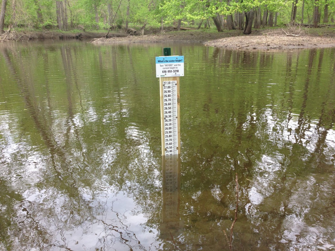
Anyone can contribute water level information with app unveiled today at a meeting of the American Geophysical Union.

They eliminate meter readers, help shift demand and address outages more quickly.
Scientists recently identified the top ways to boost awareness of global conservation with satellites and drones.

Maritime archeologists are swapping shipwreck surveys for trout habitat mapping in Lake Huron’s Sixth Fathom Bank, an ancestral spawning ground for lake trout.

High-tech produces high-def views of mysteries of the deep.

Michigan State University officials hope to collaborate with a landscape services company to use unmanned aerial vehicles to determine turf health.

The system used at the Apostle Islands National Lakeshore could be used to increase safety of other Great Lakes beaches and waterways.

Canadian scientists are launching a robotic kayak equipped with echo sounder sensors in the Welland Canal this week to see if invasive fish such as the Asian carp could travel between Lake Ontario and Lake Erie.

Red, yellow and blue squares on online maps mark where research scientists Steven Ruberg and Guy Meadows deploy techno-savvy buoys to measure nearshore conditions in the Great Lakes.
Editor’s note: This is the third in a series of stories on how new technology is giving researchers a glimpse of the critical nearshore area of the Great Lakes. With researchers hunched over remote controls, operating the Stealth II looks more like playing a video game than doing science. The Environmental Protection Agency purchased the underwater vehicle in May 2009. Using a hand control, agency scientists can operate the Stealth II as it hovers at various depths of the Great Lakes’ nearshore. The Stealth II’s camera allows scientists to map the bottom of nearshore areas and better understand habitat types.