Echo

How should Great Lakes cities tap their water wealth?
|
Detroit and Milwaukee are luring businesses with water. Could it boost economies?
Can discounted water rates and investment in water technologies transform the region?
Great Lakes Echo (https://greatlakesecho.org/tag/echo/page/137/)
Detroit and Milwaukee are luring businesses with water. Could it boost economies?
Can discounted water rates and investment in water technologies transform the region?

myBeachCast app. Image: Limno Tech
A new smartphone app provides beach advisories and other environmental information in real time. The myBeachCast app provides hourly updates from beach databases in Ohio, Michigan and Indiana, said Christine Manninen, communications and web programming director at the Great Lakes Commission, the Ann Arbor-based agency that developed the widget. Illinois will join soon. The other four Great Lakes states will be added before next May when the second version of the app will be launched, she said.

They are deadly for aquatic life and take years of pollution to develop, yet dead zones can be created in a flash by bubbling nitrogen through a lake. Are they a solution for invading carp?

With more than 10,000 miles of coastal, inland and island shorelines, the Great Lakes have the most freshwater access in the world – at least, in theory.
A western Michigan court case embodies the abiding conflict between private property owners and the public over rights to Great Lakes shorelines at road ends.

Satellite images recently showed air pollution from Ontario fires in the Great Lakes region. Nitrogen dioxide, which forms when nitrogen combines with oxygen during combustion, appears in NASA satellite images taken from July 15 to July 18. The fires caused thousands of Canadian residents to evacuate. The image was created with NASA’s Ozone Measuring Instrument. It measures the number of nitrogen dioxide molecules in a cubic centimeter.

Sony Corp. and Intel Corp. selected five students from Arthur Hill High School in Saginaw, Mich. to search for Great Lakes shipwrecks.
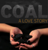
Chicago teen Luis Vega organized a march to protest pollution from the Fisk Generation Station.
His story is part of a multi-media report documenting the impact of the nation’s dependency on coal power.
The report also shows how states swap air pollution and the connection between Wyoming’s coal mines and Chicago’s citizens.
Check out the Africa Echo link where we aggregate some of the environmental news produced in the Great Lakes region of Africa’s Rift Valley. Can news communities formed around similar natural features transcend continents?