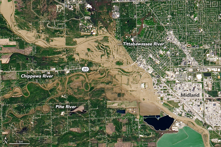

NASA’s Earth Observatory worked up this cool comparison to show the impact of the recent dam bursting in Midland.
The images above were captured by Operational Land Imager (OLI) on Landsat 8 and show the Tittabawassee River on May 20, 2020 (right), compared to June 3, 2019 (left). Read more about the images on NASA Earth Observatory.