MONDAY MASHUP: EPA Enviromapper

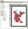
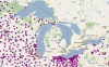
You may find out more than you want to about environmental activities in your area in the EPA Enviromapper.

This EPA map shows almost anything you want (or may not want) to know: from hazardous waste sites to the locations chemicals in use like ammonia.

MONDAY MASHUP: Cleaning up the Great Lakes

Great Lakes residents looking to lend a helping hand have a new resource at their fingertips.

An international coalition dedicated to restoring the region’s ecosystem has developed a mashup that allows users to post cleanup opportunities.

MONDAY MASHUP: Track Great Lakes ships

A mashup from the Great Lakes St. Lawrence Seaway System lets users track vessels navigating Great Lakes waterways in real time. Users can see a list of ships in transit and get information about locks and ports.

Calling all mashup creators – contest still open

If a picture is worth a thousand words, then what value does a map hold? As a journalist, I often turn to my background in geography for story ideas and elements to supplement complicated stories. Most data can be a big yawn. But display it on map with colored icons, and watch it come to life. Most of my colleagues are aware of my love affair with mashups, or interactive maps like those found on Google.