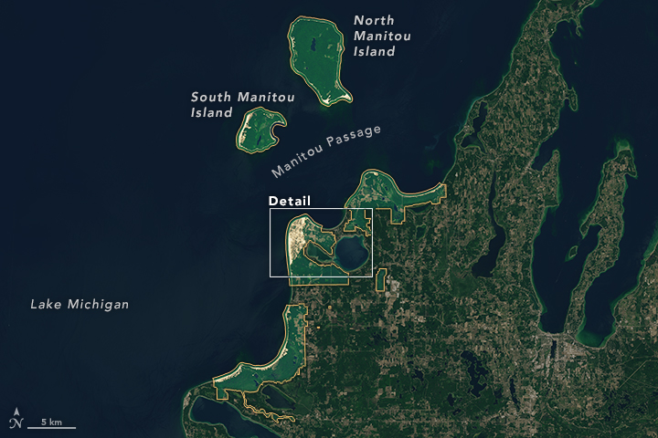
Satellite view of Sleeping Bear National Lakeshore in northwest Michigan. North Manitou Island and South Manitou Island are part of the Lakeshore. Image: NASA’s Earth Observatory
By Hannah Brenner
A ribbon-cutting ceremony was held recently for a new segment of the Sleeping Bear Heritage Trail at the Sleeping Bear Dunes National Lakeshore.
But a delay in delivering parts for a boardwalk over Narada Lake means that it is not yet fully used, said Lee Jameson, the facility manager at the lakeshore.
The segment is expected to be complete in August.
When finished, the latest addition to the bicycle and ski trail in Michigan’s Sleeping Bear Dunes National Lakeshore will run 3.6 miles from Port Oneida to Bohemian Road. That will bring the current length to 17 miles of asphalt, boardwalk and gravel.
The trail will eventually run 27 miles from Empire northeast about halfway up the
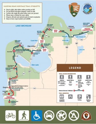
The proposed trail. Image: Sleeping Bear Dunes National Lakeshore
Leelanau Peninsula.
Projects like this by the National Park Service require special environmental consideration, Jameson said. An environmental assessment was done before the first segment was completed.
To limit environmental impact, the trail follows existing utility corridors, abandoned roads and a narrow gauge railroad. That minimizes its impact on forested areas and wetlands. Boardwalks are built with helical piles, a more environmentally friendly alternative to cement foundations.
Instead of digging up landscape and pouring permanent cement, the piles screw directly into the ground and can be unscrewed if needed. This results in minimal surface damage and the option to remove most traces of the structure, leaving only a small hole.
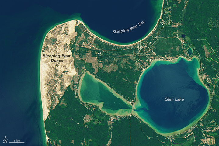
Image: NASA’s Earth Observatory
Some of the most popular locations, such as the Dune Climb and the Pierce Stocking Scenic Drive, are in the light brown dune area of the detail image above. Both can be accessed from the new trail and by car.
These satellite images were taken June 17. The agency’s Earth Observatory published them with the Ojibwa legend about how the dunes were formed.