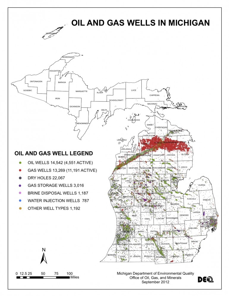
The map above shows the locations of oil and gas wells in the state of Michigan. Click to enlarge. (Image: Michigan Department of Environmental Quality)
Take a look at this map.
Cover the title, key and footer. It looks as if someone had a blank map of Michigan and began splattering paint across it.
It’s like a work of art.
But when the title of the map is revealed, it becomes obvious that all those pretty colors are actually different types of wells strewn across Michigan’s mitten.
It’s not quite as appealing anymore, is it?
“We don’t have alternatives right now to replace oil and gas, not immediately,” said Hal Fitch, chief of the oil, natural gas and minerals division of Michigan’s Department of Environmental Quality.
Until alternative sources of energy are able to replace oil and gas entirely, well pads across the state will continue to be a part of the landscape.
The images below give an aerial perspective of the northeast corner of Kalkaska County, Mich., where an increasing number of well pads can be seen over time.
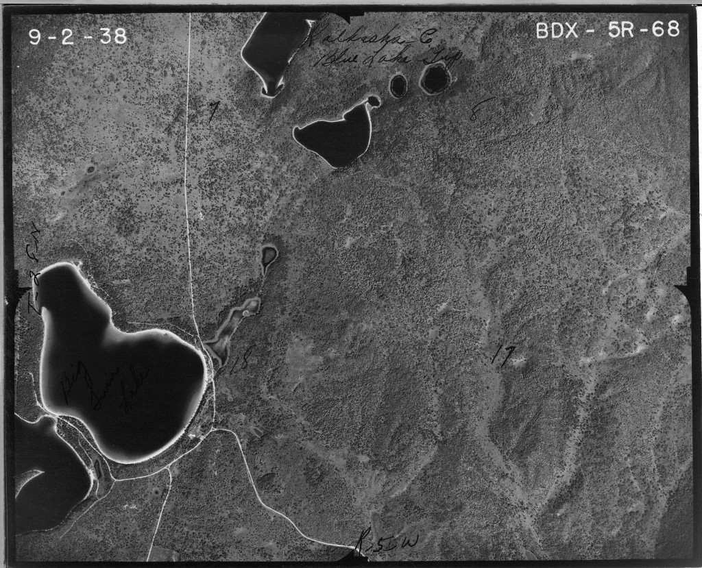
This image from 1938 shows an area of northeast Kalkaska County, Mich. Notice the two distinctly shaped lakes in the bottom left corner of the picture. (Image: Michigan State University)
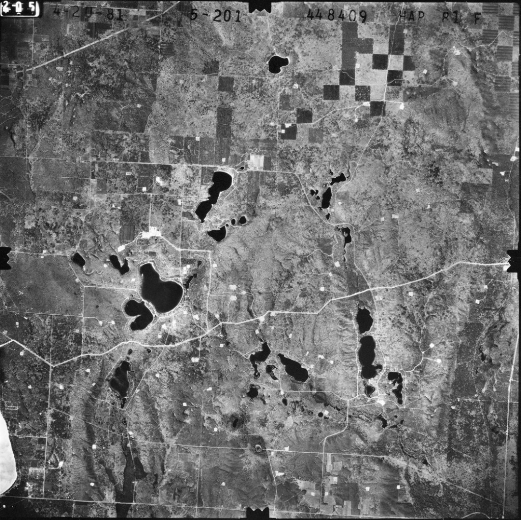
Well pads can be seen clearly as tiny white marks in this aerial photograph taken in 1981. Notice the lakes from the previous picture. (Image: Michigan State University)
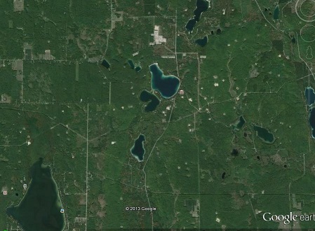
This image shows the same area of northeast Kalkaska County as it appeared in 2013. (Image: Google)