Great Lakes Echo
Editor’s note: Landscope is an occasional series about Michigan land use changes documented in the aerial imagery archive at Michigan State University’s Remote Sensing and Geographic Information Systems center.
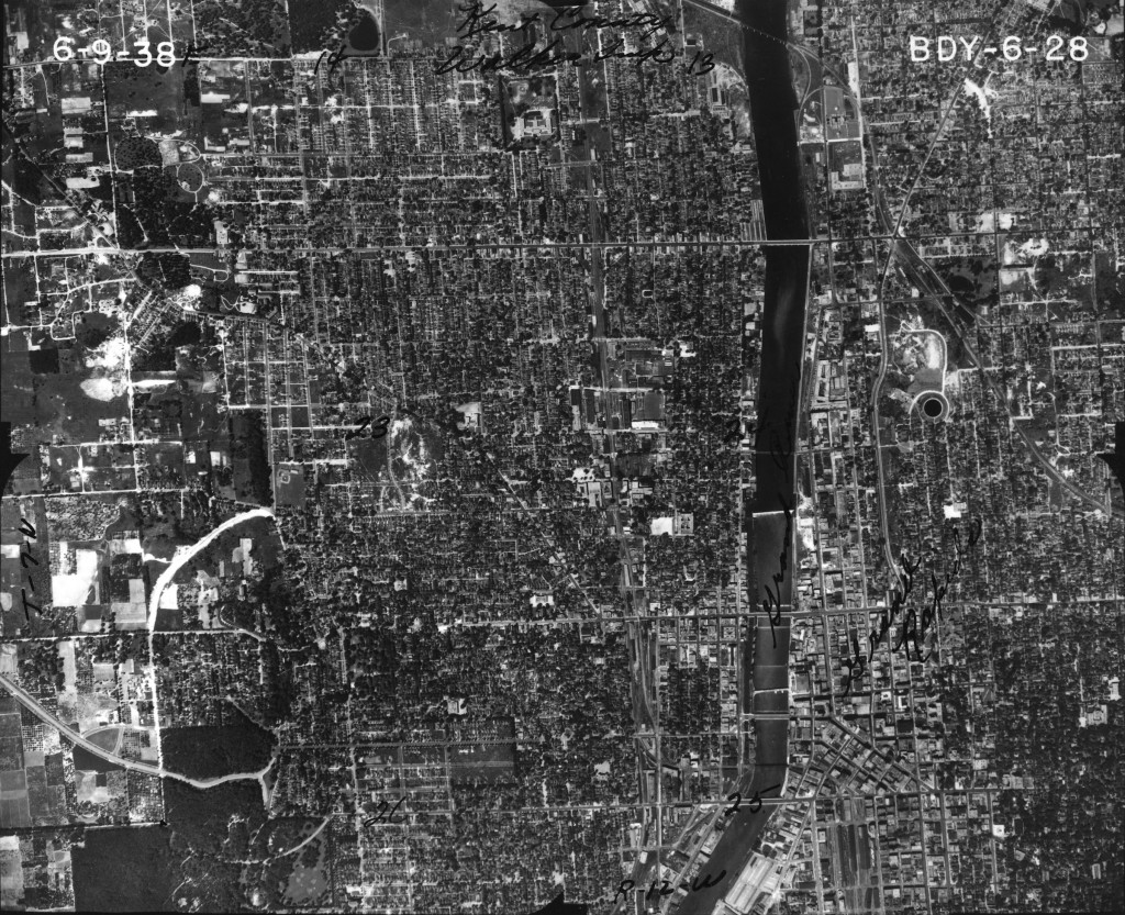
In 1938, the western suburban area of Grand Rapids had a lot of farming land and few houses.
From 1900 to 2013, Grand Rapids went from a small industrial town on the west side of Michigan to the second largest city in the state and the largest city in west Michigan, according to the 2010 U. S. Census Bureau.
From 1901 to 1921, Grand Rapids was an early participant in the automobile industry, serving as home to the Austin Automobile Co.
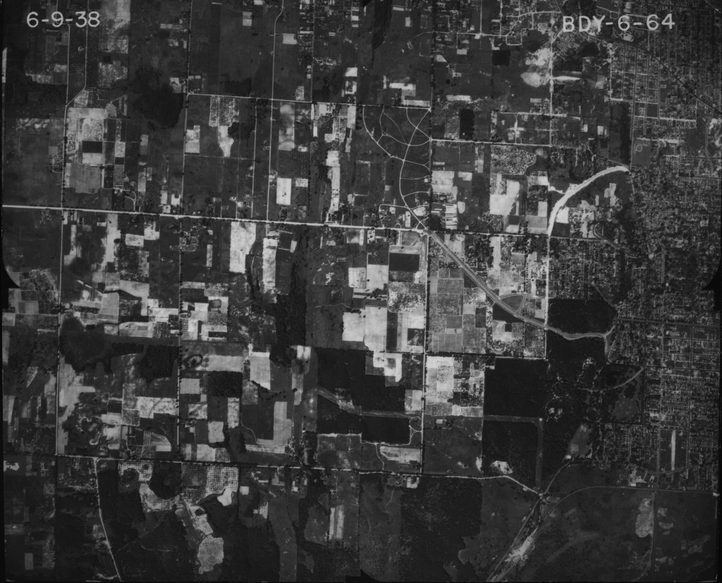
A closer image of western suburban Grand Rapids in 1938.
Now though, buildings such as the DeVos Place Convention Center, Grand Valley State University, Van Andel Arena and the Bridgewater Place highlight the city’s downtown business area.
“If you look at the distant past, there was not much going on in downtown Grand Rapids other than office use,” said Dale Fitz, a city planner for Grand Rapids.
“Once the Van Andel Arena was built, which was around the same time the DeVos Place Convention Center was built, there started to be more entertainment downtown,” Fitz said.
The Van Andel arena opened on Oct. 8, 1996, while the DeVos Place Convention Center opened in 2003.
Once the buildings were up and running, bars started to locate near them, which gave people more options to do things once they visited, said Fitz.
New freeways and interstates also brought changes to Grand Rapids.
This story is part of Great Lakes Echo’s ‘Landscope’ series.
Interstate 196, or Gerald Ford Freeway, which was built in 1963, connects Benton Harbor, South Haven, Holland and Grand Rapids.
M-6 Highway, or Paul B. Henry Freeway, was built in 1997 and connects I-196 on the west with I-96 on the east. M-6 also connects to U.S. Highway 131 in the middle of its corridor while running through several townships on the south side of the Grand Rapids metropolitan area. This connection of all the highways is called the cloverleaf interchange.
The highways and interstates decimated Grand Rapids neighborhoods as part of the urban renewal push, Fitz said.
“The urban renewal push was a time period when Grand Rapids city planners said houses were outdated, spacing was too close and buildings were not appropriate for this day in age,” Fitz explained. “So they decided to bulldoze a lot of the buildings and houses in the area to build things like highways and interstates, which caused a lot of people to relocate from their homes.”
There also use to be a few more streets in the area that were decimated because of the urban renewal, Fitz said.
Suburban Grand Rapids
There was nothing but farms about a mile west from downtown Grand Rapids in the early 1900s.
Now though, schools have been built, businesses have replaced the farms and a lot more subdivision houses are in the area.
In 2010 Grand Rapids was named the “most sustainable midsize city in the U.S.” by the United States Chamber of Commerce Civic Leadership Center and Siemens Corp.
Grand Rapids was given this honor because the city diversified its economy to its growing population.
The growing population in the Grand Rapids area has also led to the expansion of schools, said Ken Klomparens, executive director of facilities and operations for the city’s Union High School.
The school was built in 1963 and renovated in 1980. During the time it was built, Catholic Central was the only high school in the Grand Rapids district.
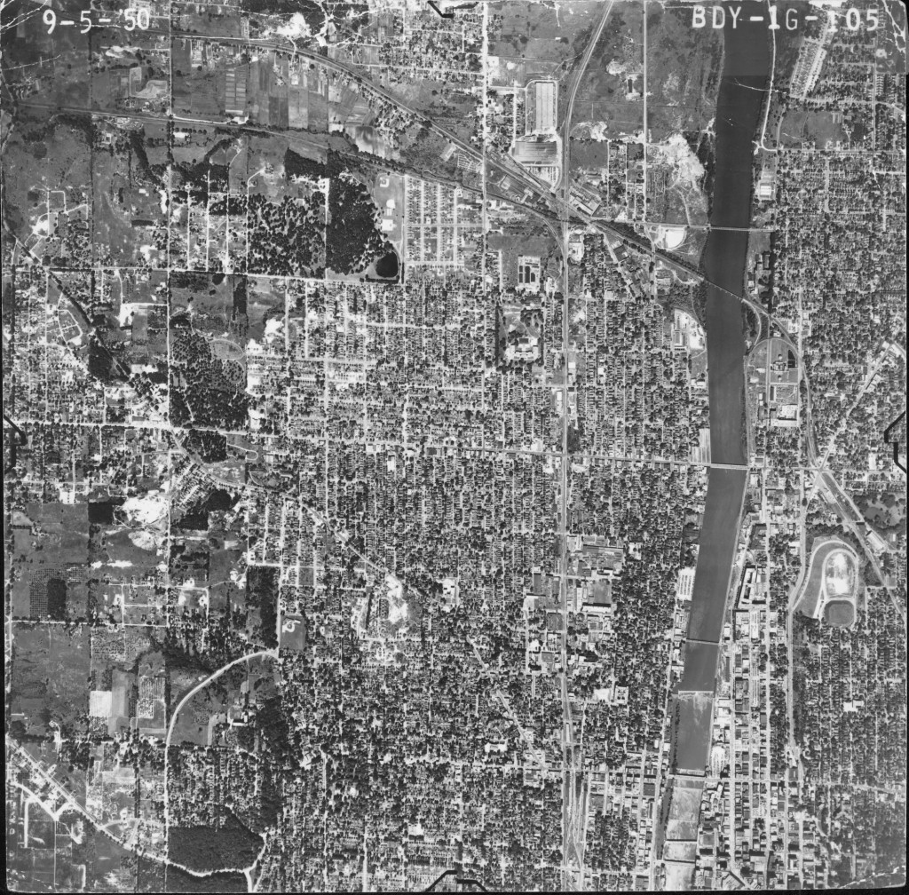
In 1950, the Grand River separated downtown Grand Rapids into two sections. There are only houses, not businesses, along the river.
“Union High School is now one of the five high schools in the Grand Rapids school district,” Klomparens said. “That factor right there should kind of give you an understanding from where this city was 50 years ago to where it is today.”
Grand Rapids is also home to five of the world’s leading office furniture companies, which is why it’s nicknamed “Furniture City.”
Klingman’s Furniture on 28th Street has been a part of the Grand Rapids community for more than 100 years. It also has been part of the city’s outward expansion.
“We use to be located right at the heart of the city in downtown,” said Ryan Kanis, furniture merchandiser for Klingman’s. “But as the city started to expand to the suburbs, Klingman’s decided in 1978 to move into the Eastbrook Mall, which is right in the middle of suburban Grand Rapids.”
Safety concerns and parking were the main reasons for the move, according to Kanis.
“When you’re a business owner in a city that has gradually seen growth patterns, you wouldn’t think parking would be a concern for you,” Kanis said. “But parking and the safety of our customers were definitely some of the challenges we had to face and eventually overcome.”
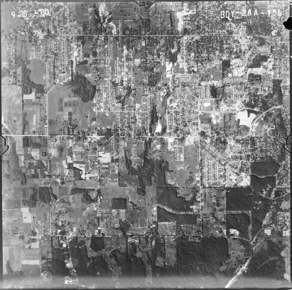
In 1960, more houses are starting to pop up western suburban Grand Rapids, but still plenty of farming land.
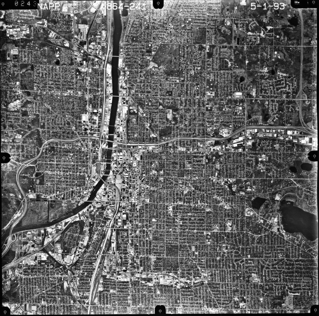
In 1993, I-196, or Gerald Ford Freeway, goes through Grand River. Businesses now line the river.
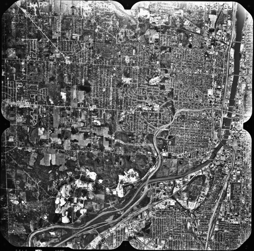
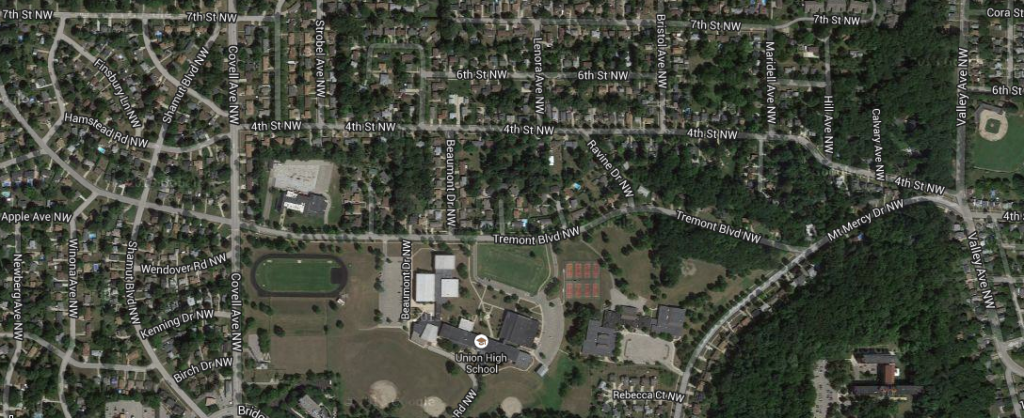
In 1993, there are a lot more houses and businesses in the western suburban area of Grand Rapids. Union High School, which was built in 1963 and renovated in 1980, is now about a half a mile west of the I-196 highway.
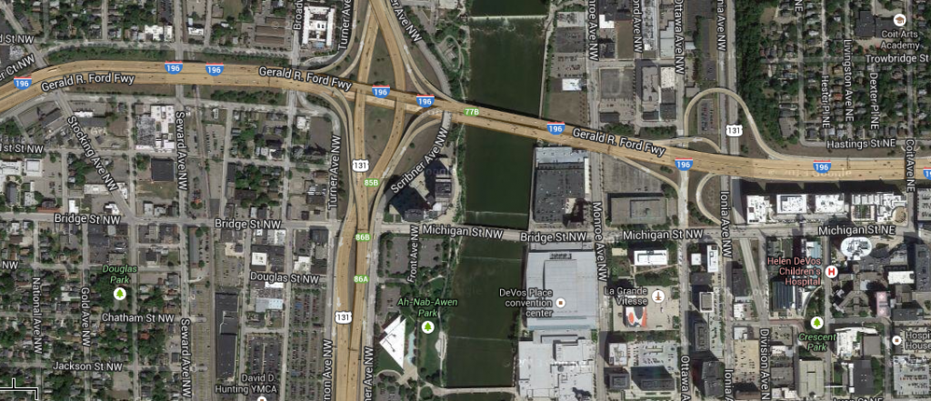
In 2013, downtown Grand Rapids is filled with businesses along Grand River such as: the DeVos Place Convention Center, Grand Valley State University and the Bridgewater Place. You can also locate the Ah-Nab-Awen Park and the Gerald Ford Museum. The famous cloverleaf interchange that connects the highways of Interstate 131, M-6, and Gerald Ford Freeway can be seen as well.
In 2013, houses and subdivisions cover much of the western suburban area of Grand Rapids.