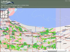
The LakeRim mashup shows land use changes along the Lake Michigan shoreline from 1951 to 1990. The pink indicates loss of natural landcover; the green shows a gain of landcover.
Northwest Indiana may be known for its steel mills, power plants and oil refineries. But there’s more to the state’s Lake Michigan shoreline than industrial facilities.
An interactive map from the Indiana Geological Survey shows a string of scenic beaches and natural areas along the water’s edge. Indiana Dunes National Lakeshore, for example, takes up nearly half of the 45 miles of coastline.
The LakeRim mashup displays both natural and urbanized areas in Lake Michigan border counties.
Explore Indiana flood plains, wetlands, streams and swamps by activating layers under the hydrology folder. Click on the different layers under environment to see how land use has changed over the past 50 years.
There are also predefined maps that show land cover changes; they are available here under the pull-down menu. One shows that much of the natural landcover within four miles of the shoreline has been restored near the Grand Calumnet area.
Other predefined maps display U.S. Army Corps of Engineers projects and areas of the Indiana Dunes National Lakeshore that have underground storage tanks – which can contaminate nearby soil and water if leaking – bacteria monitoring and land management.
Indiana University runs the state’s geological survey.
Quick note: The Autofresh button speeds up map exploration. Legends are located under the map pull-down menu.